![]()

MONTE PIZZOCCOLO
via the South-East ridge, from Ortello di Sotto
The Monte Pizzoccolo stands north of Toscolano Maderno on the Brescia side of Lake Garda. It is part of the Parco Alto Garda Bresciano.
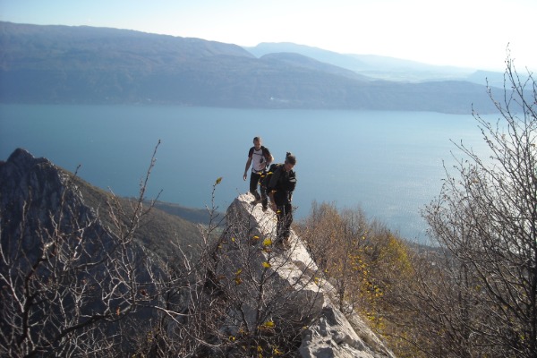
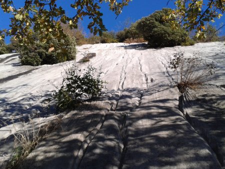
The climb via the south-east ridge, which offers very modest climbing difficulties, so that it can be performed without a rope if you have enough experience, offers a very fun climb on rocks of gorgeous limestone, and amazing views on the Lake Garda and the surrounding hills during the whole climb.
The views from the top is wonderful too, in all directions.
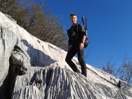
Author's Note: I thank my friends Armando and Alberto, who have shared this journey with me, and who appear in many photographs.
Access
From the bridge of Toscolano Maderno you drive west, passing through Maclino and Vigole, until Sanico. From there you take left on a steep and bumpy road in the direction S. Urbano, up to location Ortello di Sotto, where you leave your car.
The parking lot is located near the signs for the path 27 and for the south and south-east ridges.
Approach
From the car park, take the path 27, which initially is a dirt road, and then becomes a trail. You cross a bridge:

You go past a climbing wall:
Then you go past the sign for the South Ridge, and after about 200 m, you find the start of the ridge:
Route
You climb without possibility of going the wrong way, by following the ridge line, and occasional other signs, such as trail traces and cairns:


At an altitude of about 1340 m, you ignore a fork to the right, continuing always towards the top.
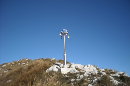
You reach a wind-solar mirror, which rotates driven by the wind, so that its variously angled mirrors send reflections visible all over the surrounding area:
Shortly after, you reach the top:
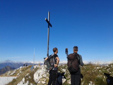
The views on the way up and from the top include Lake Garda, Monte Baldo, views over the Val Sabbia, Lake Valvestino, and the arch of mountain ranges to the north-west, such as the Adamello-Presanella:

Return
You take the path down to west, encountering almost immediately the bivouac Due Aceri:

You go down, ignoring a couple of forks and going past a former bunker, until you get to Passo Spino, where there is also the Regional Ornithological Center:

You take the path heading south, proceeding for a long way on path 8, then on path 6, until you get back to the parking pitch.
Return variant
The descent can be shortened a little by avoiding the passage via Passo Spino. To take this variant, marked in a darker color on the map, take the left instead of the right, along the return path, at the crossroads which is about 800 m after the former blockhouse:

■ gb, 2013-11-16


