![]()

SCHRAMMACHER
from Pfitscher Tal / Val di Vizze, via the South Ridge
This is a beautiful climb on mixed terrain, with a good stretch on the ridge, very spectacular. With adequate snow conditions you can reach the ridge on skis (difficulty OSA), but then you need to continue with crampons anyway.
You need the normal equipment for climbing on mixed terrain: harness, rope, crampons, ice ax, helmet, possibly snowshoes when snow conditions require it. The difficulty may vary depending on snow conditions.
Access
You go up along the Pfitscher Tal / Val di Vizze, up to the village of Stein (last inhabited location in the valley) and from there you continue along the dirt road that leads towards the Pfitscherjoch / Passo di Vizze: pay attention to take the narrow road off to the right just before the road that leads to Stein.
Although the dirt road reaches the pass, you can not get there by car: you have to stop about 4 Km before it (near the fourth sharp turn); there you park (wide places), at an altitude of about 1800 m, and continue on foot.
Route
Go back along the dirt road for about 100 meters until you see the sign that indicates the path towards the Pfitscherjoch. The trail allows you to shorten the ascent, compared to the road (that you may choose, although).
From the pass, heading north-west, you can see in the foreground the Hohewand on the left side of the hanging glacier (face upstream), while on the right you can see the ridge that goes up to our goal, which for now is not yet visible:
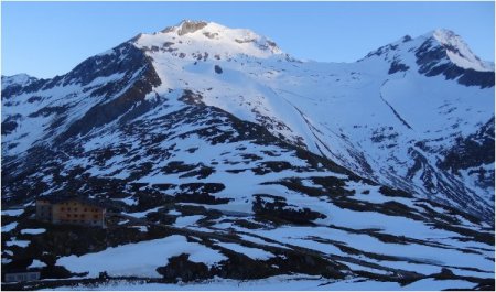
You can also see the Pfitscherjoch Haus / Rifugio Passo di Vizze, the only refuge in the area.
Once at the refuge you continue along the dirt road, until you find a plaque indicating the border with Austria: near a low building the path goes off to the left (signpost) and leads along the ridge that marks the border between Italy and Austria. Alternatively (in case of snow) you can go through the trench which is located just to the right (face upstream) of the easy ridge. Go up until you get near the glacier.
From this point you can see your destination at the end of the large glacial cirque. On your left you can see the steep slopes of the Hohewand, visible right from the pass.
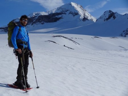
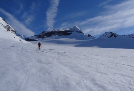
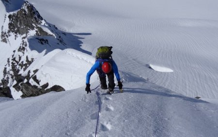
After wearing the proper equipment, you step onto the glacier and cross it in a northerly direction towards the top of the Schrammacher:
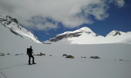
The glacier looks very broad and little steep, with crevasses in the initial part:
As you go on the slope increases, as well as the crevasses:
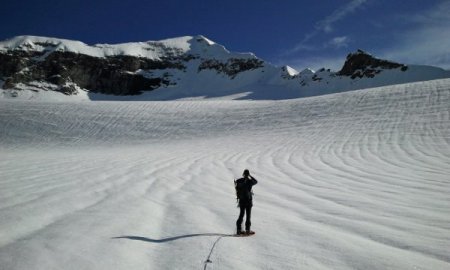
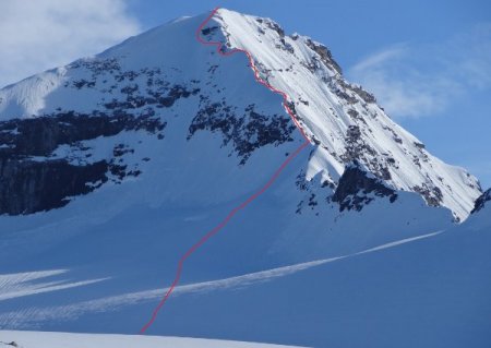
While crossing the glacier, you point to a channel just to the left of the saddle named Oberschrammach, after a tooth of rock:
Please note: the sides of the snowy cone at the foot of the channel has many crevasses!
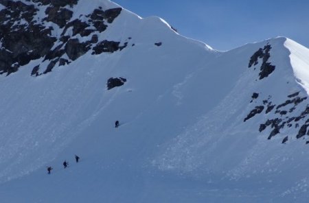
Climb the channel (which, depending on the season, can be snowy or slippery) until you reach the edge of the ridge:
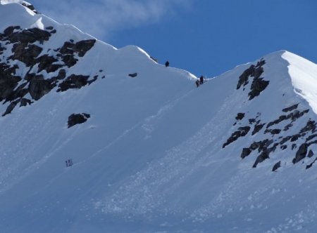
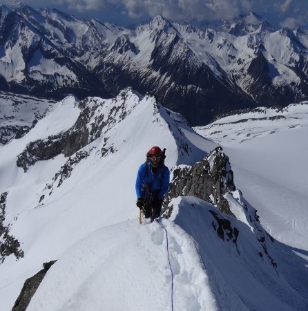
From there you climb the sharp ridge to the left:
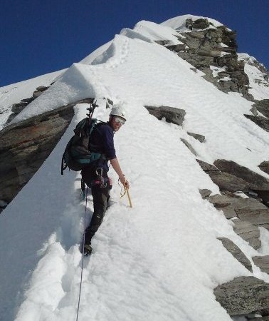
Easy and challenging stretches alternate:
Depending on the snow conditions, the ridge difficulty may vary; in our case it was covered with snow, so the only difficulties were given by the slope, exposure and the identification of a safe route, while with little snow there are some points with steps on rocks.
Just below the summit there is a rocky prominence of about 5 meters: you can work around it to the right (lanyard) or when snow conditions allow it, you can move to the left until you reach a steep gully (about 40°, be cautious in case there is little snow) that goes up near the top (we opted for this solution):
Return
Same trail.
■ bd, 2013-06-08
