![]()

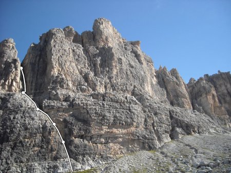
CASTELLETTO INFERIORE
by Via Normale, from Rifugio Tuckett
The normal route to Castelletto Inferiore, in the classic guide by Buscaini and Castiglioni, is described as a route of II degree. Presumably, for the two authoritative authors, it had the character of a really undemanding climb. It is a common opinion, taking into account the way degrees of difficulty are assigned today, that the real difficulty is III, III +, with a step of IV-.
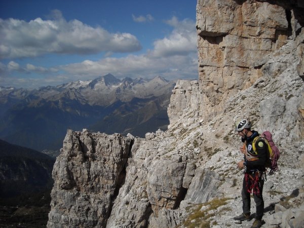
The route is close to the refuge and popular, also as part of other routes. The stops are on cemented nails; along the lengths you can place quick protections. In the second part, though relatively easy, it is appropriate not to proceed untied, due to the significant exposure.
Author's Note: I thank very much Alberto, who shared with me this climb, and who appears in several photographs.
Access
From the refuge Tucket you follow an obvious trail towards the base of the long chimney, tilted to the left, which is located in the left half of the wall. Here lies the starting point.
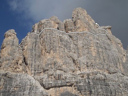
Schema and route (first part)
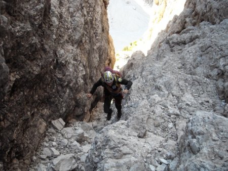
L1: You climb up along the chimney:
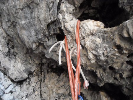
and stop on a cemented ring. 35m, III and III+.
L2: You keep on climbing along the chimney, until you reach a comfortable stop on the left side, with double cemented ring:
25 m, III and III+.
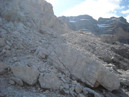
L3, L4: You go up initially along the chimney, then on a ramp and easier rocks, finally onto a large terrace covered with gravel at the base of a large chimney:
Both stops are on double cemented rings. 50 m, III, II, I.
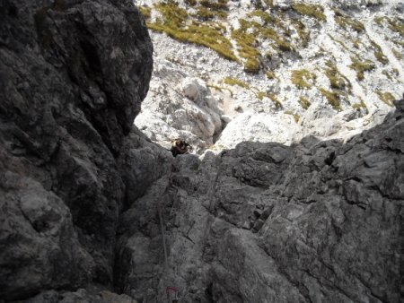
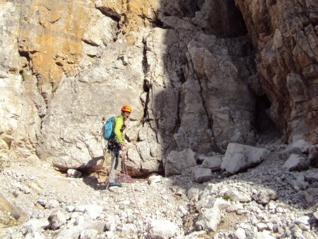
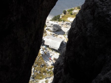
L5: You climb up along the large chimney, often climbing on its left wall. You can enjoy a beautiful view of the refuge:
You can find two good tunnels at first, then the intermediate section is hardly protectable, with a step of IV-. Finally you stop on a large tunnel:
45 m, III, III+, step of IV-.
Schema and route (second part)
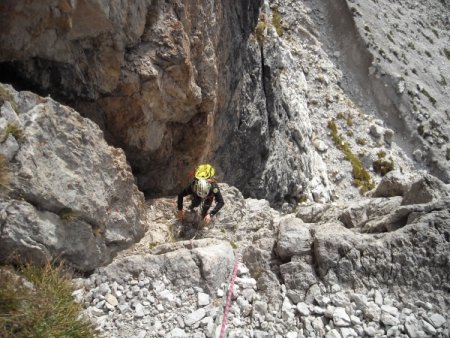
In this part, the difficulties do not reach the III degree and you can proceed in tandem. You climb up the gully above the chimney:
until you reach the clevis at its end, then you turn right on easy rocks until you reach a big ledge on the west shoulder (cairns):
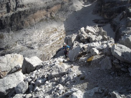
You walk along the ledge to the right until you reach the south wall, and continue along the ledge to the right through a good part of the wall, with some exposed passages:

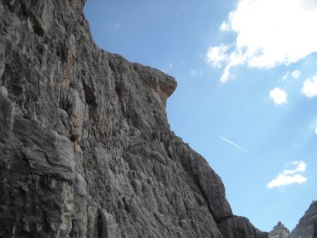
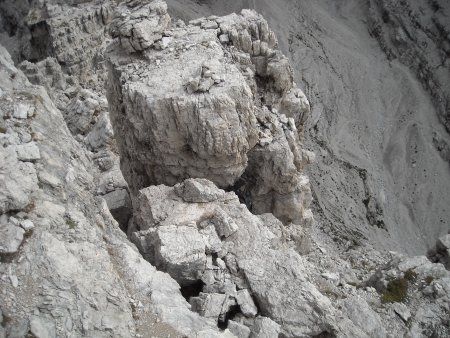
Above to the right, there is a peculiar projection, called "nose", that you can take as a reference point:
When, along the ledge, there is a ramp that goes up to the right in the direction of the nose, you take it. When you find a vertical slot with a spit, rather than climbing it, cross a little to the right, then obliquely again, almost under the nose:
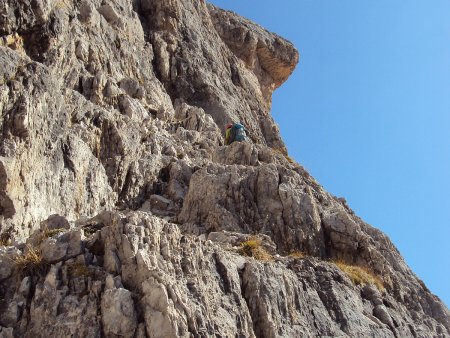
On large boulders, go up a bit and then obliquely to the left, until you reach easy rocks, on which you proceed slightly to the right in the direction of the east edge:

You skip a slit to climb to the left, reaching the easy, wide and short summit ledge that leads to the summit:
Return
You go back along the summit ledge, to the east, and go down to the slit:
Cross it, so you reach a terrace with a ring for double rope, on the north side:
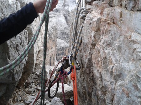
Run a double rope of about 50 m:
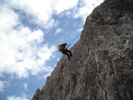
thus reaching a terrace with another ring, from which you run a second double rope of slightly less than 30 m, which allows you to reach the scree at the base of the north wall.
Descend along the trail with cairns, to the north-west, and then descend more directly to the west, up to the junction with path 316. Following it to the south, you will return to the Refuge Tuckett.
■ gb, 2013-09-26


