![]()


CIMA VERDE
via the Trail of Corazza, from Pietra
A hermit called Corazza or Coraza had built his shelter on a ledge under a roof of rock on the eastern slopes of Mount Bondone. The articulated trail that climbs to Cima Verde, passing close to that shelter, offers very interesting landscapes and views and a solitary but charming environment.
It is a recommended route in the summer, suitable for experienced hikers, but with due caution and experience can be enjoyed even in winter version, as it appears from this description.
Author's Note: I thank my friends Armando and Roberto with whom I shared the route, and who appear in several photographs. The GPS track might not always be extremely precise, especially in certain passages with very little satellite exposure, but I don't expected this to cause any difficulty in orientation.
Author's note (2019): after retracing this worthy itinerary, on a beautiful autumn day, I updated some parts.
Access
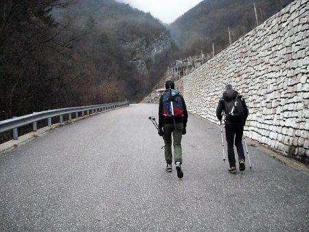
Travelling along the SP25, which leads from Aldeno to the Viote del Bondone, just after the village of Cimone, on the left, a narrow road branches off, leading to the village of Pietra. Just before the houses there is a parking lot, and another one is located almost at the town's end.
Route
From the parking, you go up the shortcut (darker track on the map), or you continue on the road:
You reach a fork with indications for Spagnolli, that you follow, and further on another fork, where you go left:
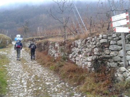
From Spagnolli, following the clear indications, you go to the west, then you cross a stream, and start to walk up more steeply in the woods:
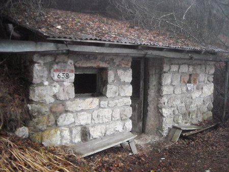
You reach location Le Fratte, where there is a shelter:
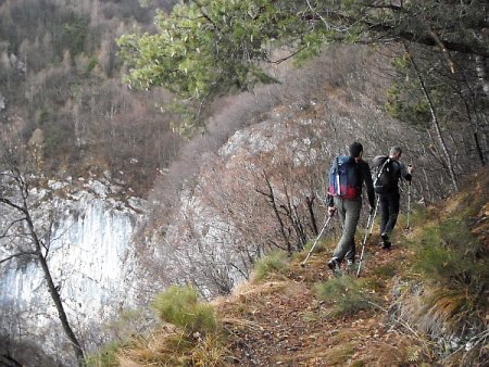
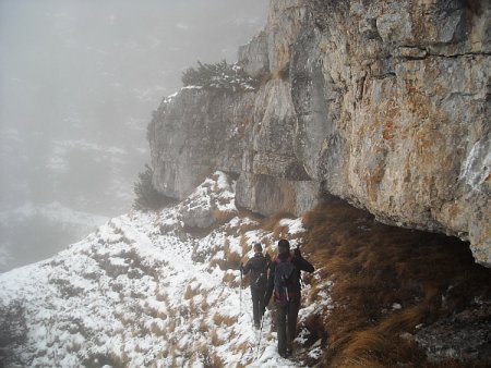
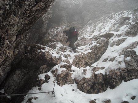
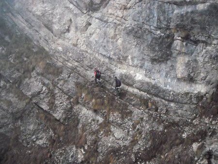
At the fork nearby, and at the next two, you always follow the signs for the path 638 of the Coraza, rising steadily and gaining altitude, finding more and more interesting passages on rocks, on ledges and through gullies.
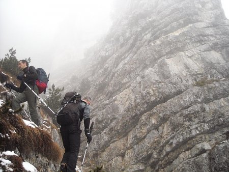
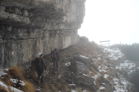
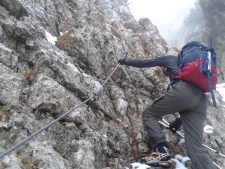
The trail is always easy to follow, on trail tracks and frequent white-red signs, and where it is most exposed or challenging, it is equipped with a metal cable.
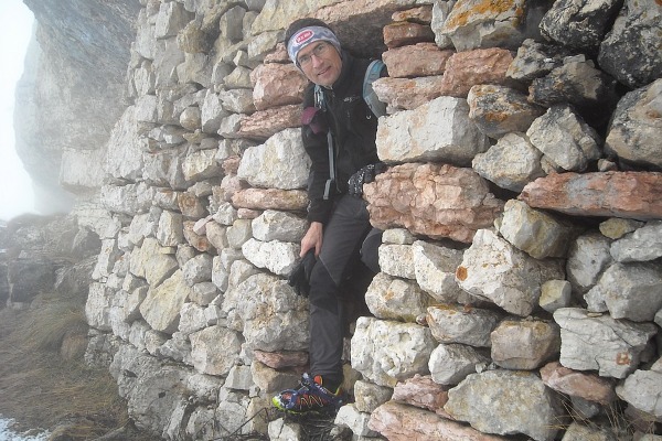
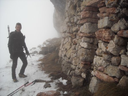
A short diversion from the path, in correspondence of a gully, at an altitude of around 1880 m,

allows you to reach the shelter of Corazza:
Then you go back to the gully and climb it up:
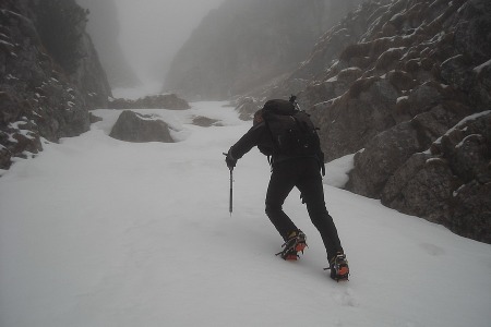
When the gully is wider, you continue on trail and easy rocks:
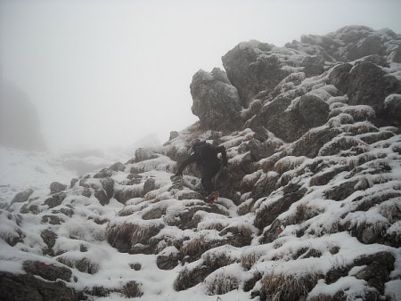
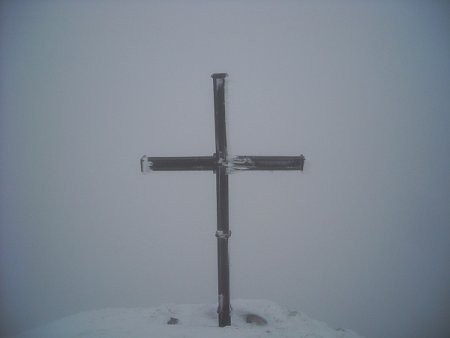
until you reach a cross at location Pala Granda.
You continue to go up until you reach the junction with trail 636, at the foot of the Doss d'Abramo, where you go to the right, heading north-east.
You go through the ridge that leads to Cima Verde, up to the junction with trail 630, from where you reach the summit of Cima Verde in a few tens of meters.
Return
From Cima Verde you take the path 630 towards Baita Sparavei. The lengthy trail descends, with some equipped stretch:
At the first fork at location Acqua del Mandret, you continue for a long stretch towards Baita Sparavei, but at a second fork, before you reach the refuge, you take the path that branches off to the right. This long trail, without signs, crosses mainly towards the west-south-west, remaining at an altitude of around 1450 with some ups and downs. Avoid taking deviations down to the left.
In the last stretch, you find some equipped parts again:
Then the trail turns more directly to the south, for some distance, until it joins the path forward. Going down on the latter, you get back to the starting point.
■ gb, 2013-12-22


