![]()

CIMA VEZZENA
(or Pizzo di Levico) and Cima Mandriolo (or Manderiolo), from Passo Vezzena
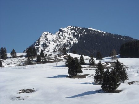
The first goal of the tour, Piz di Levico or Cima Vezzena (1980 m), with a path suitable for almost everyone, offers a pleasant and rewarding half-day trip. From the top the view is superb, embracing in particular the high Valsugana, the Lagorai and the Plateau of Vezzena.
The second goal we propose, Cima Mandriolo (2049 m), offers to well-trained hikers the possibility to extend the route in an equally beautiful and scenic way.
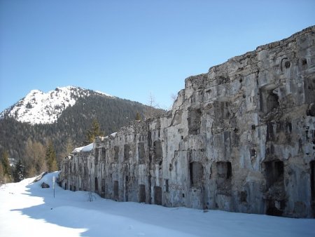
The tour is also of historical interest, touching two of Austrians forts of the First World War, that constituted the defensive Austro-Hungarian line, fronting the plateau of the Sette Comuni.
One is Forte Busa Verle (or simply Forte Verle), located shortly after the start of the route, and the second is Forte Spitz Verle, located on the Cima Vezzena. Both suffered heavy damage by the Italian artillery, but the state of the ruins that can still be seen is mainly due to the action of the "recoverers", after the war.
Access
The starting point of the hike is located at Vezzena Pass, located along the SS 349 which goes from Lavarone to Asiago.
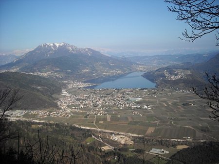
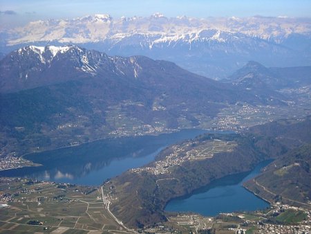
Coming from Trento, a good alternative is the scenic road of Menador. Since this is an old military road, the driver must not be distracted by the beautiful views of the lakes of Levico and Caldonazzo that the road offers.
After reaching the pass, you can park at the Hotel Restaurant Vezzena or at the Baita Verle, two places within walking distance of each other.
Tour to Cima Vezzena
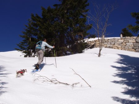
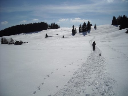
From the parking, (1404 m), take the paved road that passes in front of the Baita al Verle and go on for a hundred meters.
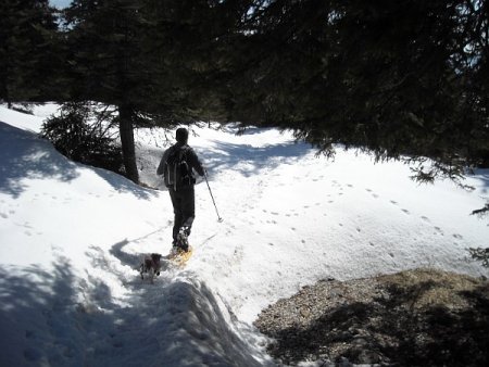
At the first junction, leave the road and take the right towards Forte Verle. With normal snow conditions, you may need to put on your snowshoes from this point.
Follow the military road, possibly cutting a couple of bends, until you get to the pass, not far from the fort (1458 m).
You continue along the military road, avoiding any shortcut directly to the north, as you would miss the turnoff to the trail.
The route described here climbs to Cima Vezzena along the summer path (205).
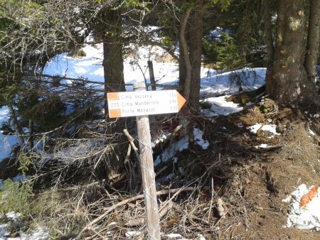
Those who wish to go up with a slightly longer route, thus less demanding, can continue uphill east along the military road (route 201).
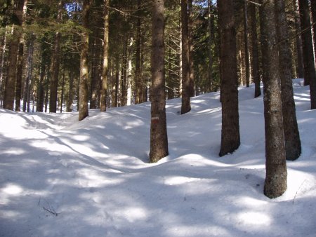
Having chosen the most direct route to the top, you climb through the forest to the north.
The path of ascent is well indicated (white-red signs on tree trunks) only in the lower part of the track. With much snow, even these signs may not be visible.
In any case, you climbs steeply heading north until you reach the border of the woods.
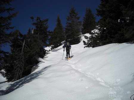
In case of moderate snow, it is possible to climb up the snowy slope almost up to the ridge, and then continue towards the top.
In case there is a lot of snow, it is rather advisable not to get out of the woods, but stay inside, climbing more gradually towards the north-east until you cross the military road that goes from the east to the summit.
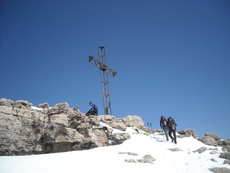
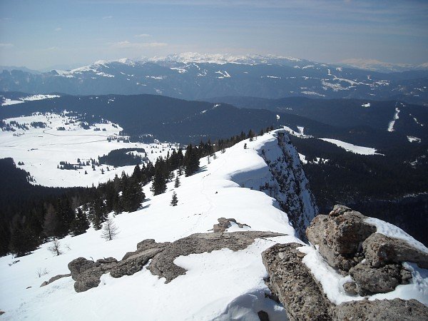
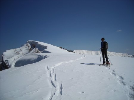
After reaching the summit (1908 m, 1h30 from the start), the view is spectacular and ranges from the peaks of the Plateau of Vezzena (Mandriolo, Portule, Verena) and all the Lagorai, to those further away, like Pasubio, Baldo, the mountains of Trento, the Paganella and, farther away, the Brenta Dolomites, the Caré Alto, the Pale di San Martino and the Marmolada.
Cima Vezzena is in itself a rewarding destination.
If you prefer returning to the starting point, you just have to go back for a hundred meters along the path forward, until you cross the trail that rises from the east (orange-colored on the map). That is the military road; in little more than an hour, it will lead you back to the starting point.
Tour to Cima Mandriolo
If, on the contrary, you wish to continue to Cima Mandriolo, you have to go down along the ridge to the east along the path 205.
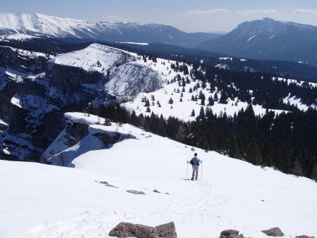
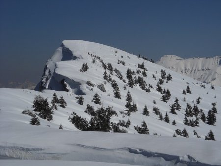
After bypassing the hill called Camin, you reach the Bocca di Forno (1788 m, 40 min from Cima Vezzena); from there you go up again, in the north-east, until you get to the top of the ridge near a minor summit identified on maps as "Elevation 2017", located on the border of the region (1h30 from Cima Vezzena).
Cima Mandriolo appears right in front of you, and you can reach it via an intuitive path in about half an hour (2049 m, about 2h from Cima Vezzena and 3h30 from Passo Vezzena).
Return
If you are willing to complete a circular route, you can go down in an easterly direction to Porta Manazzo (1795 m), an ancient crossing point between the territory of the Cimbri and the Valsugana. From there, you follow the military road to the west until you return to Passo Vezzena, thus walking for 1h30 route (a total of 7h30).
The return route we propose goes instead back along the forward path, at first, and it takes you about 2h-2h30 to return to Passo Vezzena (a total of about 6 hours): after passing again the Camin, where the path starts to climb towards Cima Vezzena, you point directly to Passo Vezzena, that you can already see in the distance (to the southwest). Continue to lose altitude until you intercept the military road from Cima Vezzena.
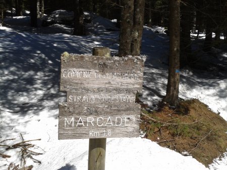
You shall take the road towards the left, walking to the south-east, until you come to a fork in Marcadei.
From there, you take the path that goes decidedly to the right towards the west-northwest.
This way, you walk along the military road, going back on the initial path section, and then turn to the south-west, passing again beside Fort Verle, and finally get back to Passo Vezzena, where the tour ends and you can enjoy well-deserved restoration.
■ rd, 2014-03-29


