FIRST STAGE
from Riva del Garda to Limone sul Garda

This stage of the Great Tour of Garda begins in Riva del Garda and arrives in Limone sul Garda, initially covering the old and characteristic Ponale road, which years ago gave access to the Val di Ledro, and is now closed to traffic.
After reaching the enchanting village of Pregasina, the route follows the classic trail for Punta Larici, continues up to Cima di Mughera, a great panoramic point, and completes with a long descent to the point of arrival.
Among the many possible paths, the ones described here present no difficulties whatsoever. The only requirement is the physical preparation necessary to overcome about 18 km of distance and 1100 m in altitude.
The effort is amply rewarded, since, as always, the lake and its surroundings never cease to amaze the eye with absolutely first-rate panoramas and scenarios.
IMPORTANT NOTICE
From September28, 2020 until March, 2021, the Strada del Ponale will be unusable, because it will be closed for maintenance work. The first stage, as described here, will therefore be impracticable. Unless you want to opt for a more challenging alternative (see Rock version, up to Pregasina), we suggest you skip the stage, or do it using public transport.
Route
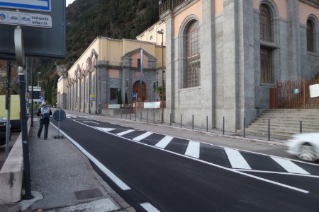
From Piazza III novembre, you walk towards the SS 45bis road, where you turn left, passing the hydroelectric power station:

Before the road enters a tunnel, you cross it, taking the narrower road that goes up on the right,

and immediately afterwards, turn left, following the signs, to take the Ponale road:

The road winds, wide and safe, along the rocky walls overlooking the lake,

with frequent tunnels (short ones: no front light needed),


In some cases, an out-of-tunnel route is available for those traveling on foot.
Continue for about 2 and a half kilometers,

until you reach a crossroads, which on the right leads to Val di Ledro, while on the left it points towards Pregasina. Turn left:


Shortly after you cross the bridge over the ravine of the Ponale torrent.

A look towards the starting point offers a nice glimpse in the direction of Torbole:

Follow the road, possibly taking advantage of the frequent shortcuts available:


This leads to Regina Mundi, the panoramic point that precedes the town of Pregasina:

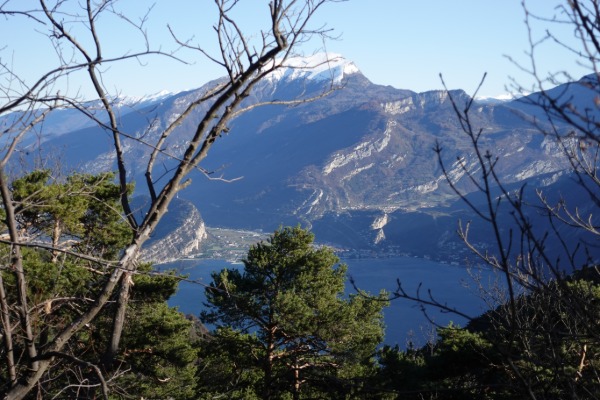
The panorama embraces the Rocchetta Group, with the sharp profile of Cima Capi, but extends to the northern shore of the lake:

Continue to the welcome sign, taking the road on the right of the SP 234 road,

go up on a steep slope,

and at the confluence with the road, turn right, uphill:

The town of Pregasina is now in sight:

In the center, turn left,

until you reach the parking under the church:

Take the stairway that goes up to the right of the parking lot, and after a narrow passage between the houses, turn completely left along a paved street:


At the crossroads just beyond the town, keep left:

You proceed on a dirt road, with some cemented sections:


This leads to Bocca dei Larici.

The summit of Punta Larici can be reached with a digression of about 200 m.
If you follow the indication for Limone, as in the photo above, take a path that leads to the Reamol Crests (orange track on the map). In this case you will continue straight to the next crossroads,

and you will follow a very scenic path, but with some exposed points.
On the contrary, to follow the easier path, at Bocca dei Larici you turn decidedly right:

You go up a wide path,

up to Malga Palaer, where you turn left:

Then go up a steeper path


up to Passo Rocchetta:

The path of the Reamol Crests also rejoins here:

At this point the panorama opens towards the southern part of Lake Garda, and the ridge of Monte Baldo appears in its whole extension:

You continue in ups and downs,


At the crossroads, take towards Cima Mughera, which is worth reaching:


The panorama embraces the Monte Altissimo di Nago,

Monte Baldo and the Alto Garga Bresciano, with aerial view of Limone:

Go back to the fork before the top, and take in the direction of Limone:

Here begins a long descent, for about 1000 m in altitude, towards the point of arrival. First on a trail,

then on a paved road:


After a long walk, when getting close to Limone, you go down to the right of the road, to take the Nature Trail, which runs alongside the San Giovanni stream:


You can continue like this up to the lakefront, or turn left into Via Tamas, and take the SS 45bis road to the left,

then taking the Lungolago Marconi, which descends towards the shore:

This brings you to the parking lot near the new port, with comfortable benches overlooking the lake:


