FIFTH STAGE
from Salò to Desenzano del Garda

Another very beautiful stage of the Great Tour of Garda, from the landscape point of view, slightly longer than the previous ones, but with a modest altitude.
Quickly leaving the urban context of Salò, the route initially crosses the green countryside that separates the town from Manerba del Garda, then climbs to the Rocca di Manerba, a spectacular archaeological and panoramic point.
Subsequently, it follows the path that runs along the eastern edge of the dizzying cliffs of the park, and after a short digression, in Moniga it descends on the magnificent lakeside, following it up to Padenghe.
In the final part, it continues along the side of the road that follows the lake coast up to Desenzano, the arrival point.
Path
You walk along Piazza Vittorio Emanuele II towards the south-east, until you reach the lakefront:

You take it to the right, following it towards the south, until you first pass the square with the monument to the Serenissima,

then the the marina,

after which you immediately turn right, along Via Brezzo, that after about 150 m leads you to a roundabout, where you continue straight into Via Montessori:

You continue straight for about 400 m,

including an intermediate roundabout, until the end of the street, where you turn left into Via Anime del Purgatorio:

You continue straight ahead, continuing on Via Muro,

which after a large double curve flows into Via del Panorama, where you cross, in order to take the cycle / pedestrian path to the left (south-east):

With a wide curve the road turns east,

until after about 1200 m you reach a large roundabout.
You go around it on the right,

until you reach the opposite side,

to take the small road in front of you, which goes up for 30 m to the left, then turns sharply to the right (south-east),

with indications for a cycling route to Desenzano.
You proceed along the countryside,

and after about 1200 m, when you cross the intersection with Via Madonnina, you continue straight,


but shortly afterwards, you turn right on a dirt road:

You follow the road for about 1600 m,

keeping on the left at the first crossroads,


going straight at the next intersection,

and enjoying the pleasant views:


This leads you to an crossroads where the road intersects Via Benaco and Via Bresciani: take slightly left, along the road,

and shortly after you keep left at the next crossroads:

Continue straight on for about 750 m,

ignoring a couple of crossroads on the left,

going through the suggestive Via XX Settembre in Pieve Vecchia,

to quickly reach the intersection with the provincial road, where you turn right,

and immediately to the left, leaving behind the characteristic church:

You continue south-east, on Via Pieve Vecchia,

you cross Via della Repubblica,

to continue on Via dell'Edera.
Shortly after you pass by the entrance to a campsite:

After another 200 m, you turn right across a bridge,

and follow the road,

following the curve to the left.
At the intersection with Via del Rio you turn left,

then right on Via dei Tulipani,

then you cross Via Belvedere,

to continue straight on Via del Torchio:

After less than 400 m, you leave Via del Torchio to turn left into Via del Passero:

After another 500 m, slightly uphill,

you reach an intersection, where you turn left into Via Rocca:

Now the road gets a little steeper, and goes up in wide curves,

passing the museum,


then entering the archaeological area:

You go up on the right following a path:

then on the left you find the ruins of the fortress:

If the day is clear, the views are fantastic, in all directions:


You go down a steep path, sometimes with steps, at times a bit abupt, but with a rope for help,


first describing a zigzag, then descending north-east, until you reach the Sasso:

The location, dizzyingly on the edge of the high cliff,

offers more spectacular views:


You now continue along the Path of Terebinto, which winds south, not far from the edge of the cliff,

enjoying frequent vertical glimpses, and seagull flights:


The Rocca and the Sasso are now behind,

but the cliff still offers some thrills:


You now proceed in the woods, towards the south-west,

and at a crossroads for Porto Dusano, you turn left:

After a few hundred meters,

you take the road, to the left,

and you will soon reach the port:

You continue on,

but soon you turn right, following the all directions sign,

then you go up for about 400 m,

follow the road left turn,

and at the crossroads turn left, downhill, in Via del Gazzo.

You follow the curve to the right, continuing on level ground,

turn left in Via del Torchio,

which then turns to the right and then proceeds straight:

Then you turn right into Via Scazzola:


At the next crossroads, you turn left,

immediately leaving the road, to proceed on a dirt road, in a south-south-west direction:

You meet a small road, and take it on the left,

but after about 80 m, turn right again onto a dirt road:


You follow three sharp bends, left-right-left, juggling in some muddy stretch:

At the confluence on the road you turn left,

and shortly after on the right:

At the next crossroads, you continue straight on Via San Sivino,


for about 350 m,

then take a dirt road to the left:


You arrive in Via Scaletta, where you turn left,

you go down a staircase,

thus reaching the lakefront, which you take to the right:

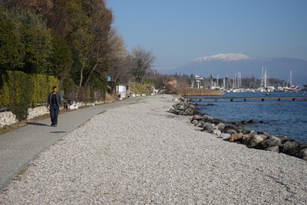
You walk following the lakefront for more than 4 km, soon passing the port of Moniga:


Just before the port of Padenghe, you turn right,

uphill,

shortly reaching the provincial road, which you take to the left:

After a stretch with a sidewalk on the left side,

you go along a stretch with a sidewalk on the right side,

then you cross back to the left side,

and continue further south-east.
You reach and pass the large junction between the provincial road and the road to Desenzano, after which you continue on the trail on the left side of the guard rail,

which then becomes a paved track:

You continue for more than 3 km, first on the track,

then on the sidewalk of Lungolago Cesare Battisi:


So you reach the center of Desenzano, you cross the bridge over the old port,

and you reach the pier, your point of arrival:

