
CORNO DI CAVENTO
from Malga Bedole

This is a very long and varied tour that leads you to explore various environments in an area extremely rich in natural beauty, that witnessed almost a century ago some of the bloodiest events that took place along the Italian-Austrian front during the First World War.
In the area there are several refuges, but not exactly along the way, so it is advisable to carefully evaluate you physical training, and the weather conditions.
It is possible to split the route into two or more days, sleeping in bivouacs or refuges, at a distance of one or two-hour walk from the itinerary.
Glacier equipment is needed.
Access
You go up along the Val Rendena, to the village of Tione Rendena, up to Carisolo. You take, just after the village, the deviation for the Val Genova which is on the left. You go up the valley along its entire length beyond the beautiful waterfalls of Nardis on the right (orographic left) and Lares (on the left - the orographic right) until you get near the Refuge Bedole.
Depending on the month, the access to the valley may be limited or require payment; check with the park institution of Adamello-Brenta. Minibuses allow you to travel without a car (depending on periods and times).
Ascent
After parking the car in the vicinity of the mountain hut Bedole, you walk along the forest road that easily leads to the Refuge Bedole, which lies near a pond in the hollow where the wonderful Val Genova begins.
You leave the shelter on the right and take the path of Matarot (number 241), initially broad and flat (up to the cableway that supplies the Refuge Madron), later gradually narrower and steeper.
After passing a first stretch through the larch forest you reach a green plateau where the stream flows. In the midst of this idyllic place is the old mountain hut Matarot Bassa.
You cross the two wooden bridges and continue along the path that gradually becomes a gravel track in the middle of the stream, and then continue on the rocks smoothed by water along a secondary stream.
You arrive in this way at the top of the valley of Matarot; here the trail becomes less evident, and runs along the flanks of the foothills of the Lobbia. Due to erosion, every year the track changes more or less significantly.
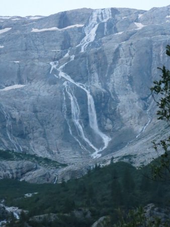
After a considerable effort, you reach the rocky ramparts that close the valley; on the left you see a big waterfall (depending on the time and period, the amount of water that falls can greatly vary) that pours into the valley the water that results from melting of snow and ice of the Lobbia Glacier, that is in a higher position, still not visible.
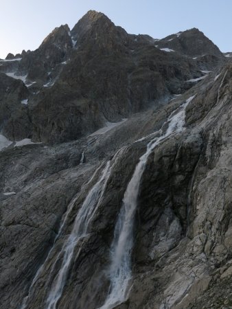
You go along a long stretch equipped with cables (be careful in case of rain, because the slippery rocks are smoothed by the ice), that goes up the rocky slope, not too steep. The last part of the rocky section, less steep and therefore not equipped with a lanyard, leads you up to the top of the glacier.
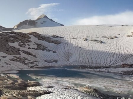
Here, near a pond of melting ice, you leave the visible track (leading to the shelter at the Refuge Caduti dell'Adamello, near Passo della Lobbia Alta) and you go to the left, up on the glacier.
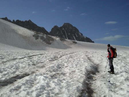
There, after wearing the appropriate gear, you start climbing the glacier (initially not very steep and with few crevasses) in the direction of the Passo Val di Fumo, overcoming on your right the Cresta Croce and the Dosson di Genoa, and on your left the Crozzon di Lares and peak Attilio Calvi.
Beware of some crevasse near the pass.
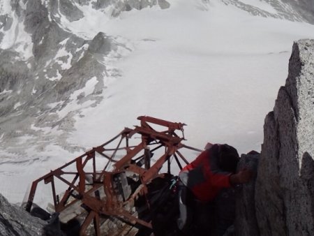
Once at the pass, continue uphill to the left towards the Passo di Cavento. In the past, the glacier was much higher and therefore the passage was easier, now the top of ice section is about 50 meters lower, so it is necessary to climb up (with the help of a metal cable), on rocks and debris. Without the lanyard, the difficulty would be between the first and the second degree.
Near the pass is the bivouac Laeng, a rudimentary metal sheet shelter. You now go back down the other side of the pass, again on rocks and debris (metal cable) to move to the glacier of Lares. Beware of the crevasses.
You go along the right mountainside of the Corno di Cavento, until you get to the south-east side, where you go up along snowfields and scree (in the past this part of the trail was covered with ice up to the top), until you get a little below the summit. There you can find an extraordinary sign of the great war: a cave digged into the rock, at several times, first by the Austrians and then by the Italians.
The cave, normally closed, is opened and can be visited during some periods, thanks to the volunteers of the SAT section; you can get information regarding the days and times of opening, at the various refuges. Even just a visit to the cave would be worth the effort of the climb.
Near the top there are also some war posts, the remains of huts and the remains of a cableway.
From the top you can enjoy a wonderful 360° view on the peaks and glaciers in the area and beyond, mostly from the area of Ortler-Cevedale).
Descent
It is possible to go back along for the path of ascent, or (as shown by the track included here), down along another wild and beautiful valley, the valley of Lares.
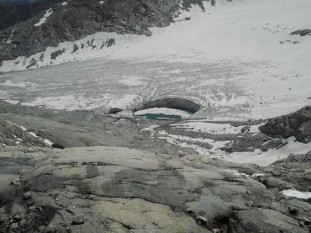
You return to the Passo di Cavento, but before getting there you go down to the glacier of Lares in the direction of the lake. Beware of the smooth rocky outcrops you meet at the end of the glacier, now left uncovered by the retreating ice.
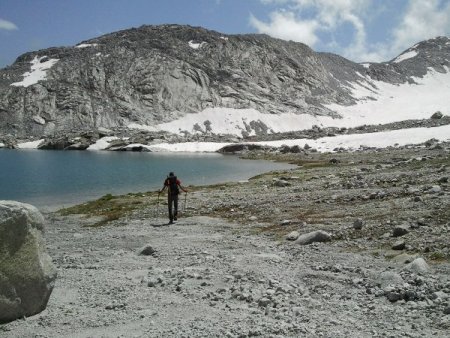
In this area you can also notice an impressive hole in the glacier. At the lake, take the trail 214, that with some steep and athletic steps leads down through meadows and larch forests, near the ruins of the old shelter Lares, and then down to the valley.
Here the nature seems to hide the trail, which is forced to various deviations between the boulders and lush vegetation.
This leads to the mountain hut Lares, which can be used also as a bivouac. Continuing along the trail, you descend close to the spectacular waterfalls of the Lares and you will reach the valley floor near the shelter Fontanabona.
Hence it is necessary to go up the Val Genova for a dozen kilometers to get back to your car: it is advisable to travel by minibus (if you arrive on time, attention to schedules).
■ bd 2013-07-28