EIGHTH STAGE
from Torri del Benaco to Malcesine

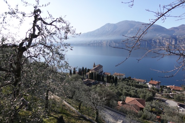
This beautiful stage of the Great Tour of Garda goes in gentle ups and downs along the first slopes of Monte Baldo, among woods, olive groves and enchanting small villages and hamlets, with continuous glimpses and panoramas of rare beauty on the lake and its surroundings.
Much of the itinerary goes along the Sentiero del Pellegrino (Pilgrim's Route), along dirt or paved paths, trails and secondary roads. The final part takes place on the beautiful lakefront between Cassone and Malcesine.
Along the way, some especially interesting places can be found, as the church of San Siro, the graffiti of Crero, the tibetan bridge, the nativity scenes of Campo.
Path
Starting from the port of Torri del Benaco, you head north along the lakefront, and soon you turn right into Piazza Umberto I,

going up to intercept the Gardesana provincial road, SR 249; you cross it, continuing straight on Via per Albisano:

After about 150 meters, you keep left,

and shortly afterwards, on the left, you find two forks, close to each other; you ignore the first one, for Via Rossini, and take the second one for Località Loncrino:

You go up the paved road, for about 350 m,

and near the hamlet of Loncrino, you turn left,

and then immediately left again:

You follow the directions of the Sentiero del Pellegrino, a constant and reliable indication for most of the stage.
Panoramic views of the lake are frequent, such as this on Torri del Benaco:

You cross the hamlet of Coi,

and at the exit of the town, you turn right,

and immediately left.
You now walk along a country road, among the olive trees:

After about 400 m, at a crossroads you turn left,

and shortly thereafter, at the next one, left again:

After less than 400 m, you intersect Via Mazurine, crossing it obliquely to continue straight along the path:

You will now proceed for almost 2 km,

with a last glimpse of Torri del Benaco,

walking through woods and countryside:


Then, at a crossroads, you keep left:

About 500 m later, a crossroads offers the possibility, turning right from the path,

to reach in a few meters some limestone plates where graffiti are engraved, dating back to various eras, even very ancient:


You return to take the original path, soon going to reach the beautiful hamlet of Crero:

On leaving the village, you turn right,

you reach and pass the church of San Siro,

and immediately after, at the crossroads, you turn left:

The views of the lake are really beautiful; your gaze goes along the east coast up to Malcesine, and in the background, well beyond Monte Brione, you can even see the snowy profile of mount Paganella:

You continue for less than 400 m,

and at a crossroads, you keep to the right:

Less than 400 m later, the path, downhill, has a sharp right curve,

then it goes up drawing a serpentine, and reaches a tibetan bridge:

The bridge, of solid construction and well anchored, barely sways, and is equipped with excellent lateral protection nets. Nevertheless, the view of the ravine below, several tens of meters deep, has a certain effect.
You take the path again,

and after about 400 m, at a crossroads, you keep left:

You walk along Via per la Casetta, for less than 700 m,


and at the crossroads with Via Manzoni, you turn right:

So you enter Pai di Sopra,

soon reaching the beautiful central square:

In a few steps you can go up to the church, an excellent panoramic point:

After leaving the town, heading north-east, you proceed northwards along Via per Ca' Tronconi, for less than 900 m:

This leads you to the hamlet of Ca' Tronconi,

where you turn left, downhill.
You go down in the countryside,

with sweeping lake views,

and near the first houses, you leave the road to take the path on the right:


Soon the trail merges into Via Salto, crossing it obliquely, to continue on the path:

You proceed again on the path,

and soon you intercept a road again, which you cross obliquely,

to continue on the path:

A little further on, you cross an asphalted road again, and continue straight on the path:


You quickly arrive to intercept a sharp bend in Via Pasola; you take the branch uphill:

You now proceed for little less than 2 km on Via Pasola.


This brings you to the hamlet of Biaza, where at an intersection you keep slightly to the right, towards Fasor,

which you reach and cross shortly after:

A couple of minutes later you leave the road to deviate left along the path, still following the signs for the Sentiero del Pellegrino:

You now proceed for about 1500 m, along a beautiful path,

with excellent views of Castelletto di Brenzone,

ignoring an intermediate crossroads,

up to the characteristic and suggestive hamlet of Campo:

You cross it to the left, then turn right, and take the crossroads to the left shortly after the town:


At the next crossroads, you keep right:

You continue for about 1 km, passing Marniga,

and going down to Magugnano, but going beyond it without actually crossing it,

keeping left at the next crossroads:

In a short time you reach the hamlet of Boccino, where you proceed straight ahead, along Via San Benedetto,

passing through the hamlets of Venzo,

and Castello,


where at the exit of the village you take slightly left, taking Via Belvedere.
The road runs for about 500 m,

meeting and passing the hamlet of Borago, where you follow the double curve of the road, going downhill.
After about 500 m you cross the hamlet of Pozzo,

and shortly after that of Sommavilla,

and take slightly right, on Via Sommavilla, at the next crossroads:

You walk on it for less than 700 m,

with beautiful views of the lake,

then you take a crossroads to the left:

This way you cross Cassone, downhill, until you cross the provincial road:

You almost immediately reach the marina,

and take the lakefront to the north-east:

You follow it, for almost 2 km, until you reach the promontory of Val di Sogno.
There you follow Via Val di Sogno, which cuts the promontory, and follow its narrow curve to the right,

and then turn left, before the hospital, at the intersection with the regional road:

A narrow downhill road

soon leads to the lakefront again.
You follow it, always towards the northeast,

for about 1600 m, approaching Malcesine:

Finally, you easily reach its port:

